Discover Trails, Wilderness, & High-Altitude Adventure Near Vernal, Utah
Ashley National Forest is one of Utah’s greatest outdoor playgrounds, encompassing almost a million and a half acres in northeastern Utah and southwestern Wyoming. It stretches across three geographical areas: the east-west range of the Uinta Mountains, the Wyoming Basin, and the Tavaputs Plateau. Elevations range from 6,000 feet to over 13,500 feet. This vast forest offers endless opportunities for hiking, OHV riding, backpacking, camping, fishing, and scenic exploration.
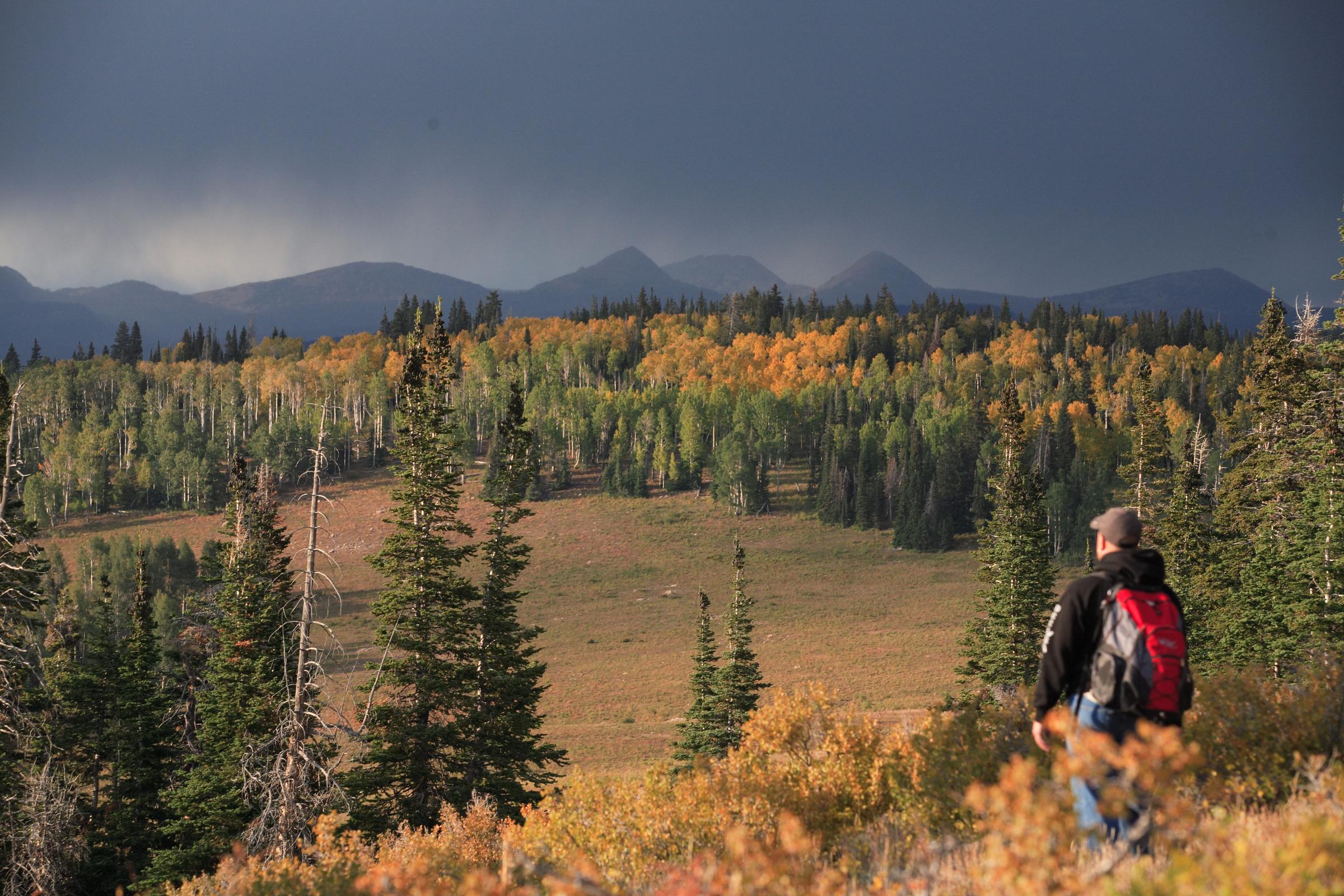
A Landscape Built for Adventure
The forest has a vast range of terrain and ecosystems, including:
• Steep canyons & high mountain peaks
• Glacial basins with alpine lakes
• Large open meadows
• Desert badlands
All contain a rich diversity of vegetation and wildlife. The grasses and shrubs of the high mountain desert are replaced by pinion and juniper as the elevation rises. In mid-elevation areas, aspen dominates and becomes mixed with conifer.
Higher up, the vegetation changes to conifer forest composed of lodgepole pine, fir and spruce. Grasses, forbs, and stunted, twisted conifers called krumholtz are found above timberline. Within its boundaries are Utah's highest peaks, Flaming Gorge National Recreation Area, the Flaming Gorge -Uintas National Scenic Byway and the High Uintas Wilderness.
Popular Recreation in the Ashley National Forest
Ashely National Forest offers recreation for all types of visitors.
Popular recreation includes:
Boating: Ashley National Forest offers exceptional boating opportunities on high-country lakes and reservoirs, including access to Flaming Gorge National Recreation Area.
Camping: From developed campgrounds to remote dispersed sites in the mountains with sweeping alpine views, the forest provides camping options for every traveler’s camping style.
Hiking & Backpacking: With hundreds of miles of trails ranging from easy forest strolls to ambitious high-alpine expeditions, the forest is a premier destination for both casual hikers and backpackers wanting multi-day trips. Find hiking trail guides & information here.
Hunting & Trophy Fishing: With world-class trout waters and thriving big-game populations, the forest offers exceptional hunting and fishing opportunities throughout the season.
OHV & Off-Roading: Designated OHV routes wind through canyons, forests, and high ridgelines. Riders can enjoy diverse terrain, beautiful views, and easy access from the Vernal/Dinoland area. Find OHV trail guides & information here.
Biking: Bikers will find plenty to explore, from forested singletrack to long scenic dirt roads. Routes range from easy family-friendly rides to more challenging backcountry terrain. Find biking trail guides & information here.
Snowmobiling: In winter, the forest transforms into one of Utah’s best snowmobile destinations. Groomed trails and wide-open powder fields offer everything from easy cruising to high-adventure riding in the high Uintas. Find snowmobile trail guides & information here.
Scenic Drives: The forest is home to some of the region’s most beautiful roadways, including the Flaming Gorge-Uintas National Scenic Byway. These drives feature dramatic canyon overlooks, wildlife viewing pullouts, and access to major trailheads.
Wildlife Watching: Keep an eye out for elk, moose, antelope, bighorn sheep, and even bears and mountain lions. You’re also likely to see countless smaller species. Dawn and dusk are the best times for wildlife viewing.
Trails Near Ashley National Forest
Ashley National Forest offers a wide range of trails, many of which are highlighted in our trail guides. You can use our trail pages to explore options for hiking, biking, OHV routes, horseback trails, snowmobiling, and more - each with maps, difficulty details, and route notes.
Whether you’re looking for a short lakeside walk, a scenic forest loop, or off-road routes with big views, the forest has something for every adventurer. It’s a great starting point for exploring the diverse terrain surrounding Vernal.
Best Time to Visit Ashley National Forest
You can visit Dinoland and the Ashley National Forest all year long, but be prepared for seasonal conditions in each area. We recommend:
• Late spring–early fall for most hiking and camping
• Mid-summer–early fall for high-alpine trails
• Year-round for scenic drives and lower-elevation adventures
Weather changes quickly in mountain environments
Know Before You Go
• Cell service is limited in many areas
• Temperatures vary significantly with elevation
• Roads may require high-clearance or 4WD, especially in spring or after storms
• Always pack extra water and layers


 H: 89°
 H: 91°